
I've been a fan of both aviation, and tinkering with electronics and data, for as long as I can remember.
When working with the ESP8266 microprocessor to control LEDs for another project I had the idea to make a simple indication of aviation weather (from a source known as the METAR or METeorological Aerodrome Report)
These cryptic nuggets of data look something like this (makes sense to a pilot, honest)
EGPL 081320Z AUTO 15010KT 9999 -RA FEW006/// BKN014/// OVC020/// 11/10 Q1013
And are usually represented on electronic maps such as SkyDemon with a simple colour scheme (Green, Amber, Red, Purple) which represents the flight weather conditions.
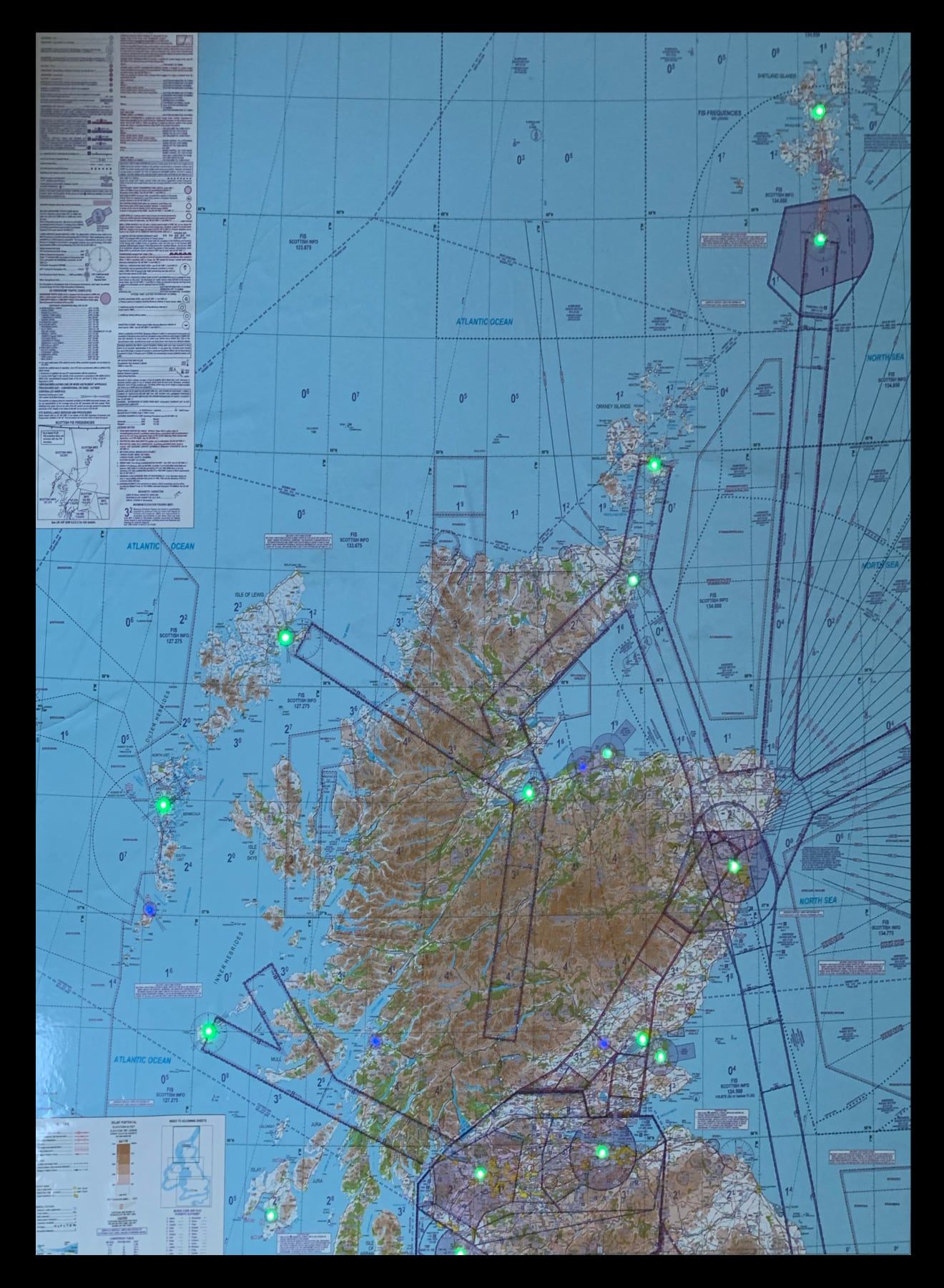
In mid-2017 I made a few customised charts for friends, and one is displayed in my local flying school and has been a talking point of a few visitors,
Following months of work improving the design of the firmware, and building tools to allow people to customise them, I have made them available for sale at https://www.metarcharts.co.uk/
There is a similar product across the Atlantic in the USA called Metar Maps. It's worth mentioning at this point a big thank you to Richard Freilich of MetarMaps.com who I discussed this (mainly because my name is pretty close to his!) and was fully supportive of our project.
The elephant in the chart
Update (November 2020)
It seems we may be able to reprint scaled versions of the official charts!! (I can't express how exciting this is for someone who's spent almost a year trying to arrange it)
Watch this space (and metarcharts.co.uk) for an update!
Now, firstly let me say I have a huge respect for NATS and Air Traffic Controllers in the UK, they are our eyes on the ground and the service provided by Scottish Information and London Information to those of us flying VFR is invaulable.
However, the red tape within other parts of the organisation - not so much.
I had hoped to reprint the 1:500k chart you can see above at A2 size to make it a bit more manageable as a poster on a wall but having spent months trying to find the right contact I eventually got the following response;
All requests whether big or small come under the same umbrella and the contract stipulations, costs etc. are the same. Generally they are too expensive for individuals. As an example the set cost is £1000 plus VAT. Sorry to be the bearer of bad news but there are no exceptions.
Now, actually, £1000 as a "set cost" doesn't sound that bad, we could do that, it would take a few charts to pay for it of course but it might be possible ... so I eMail back and he clarifies;
The £1000 cost is just to set up a contract. On top of that is a £220 fee each and every time a chart is produced and that cost applies each and every chart on the contract. As it would classed a commercial venture there are royalty fees to added also with a minimum cost per annum which is quite substantive for a small company. A contract allows company to use a chart in their production process but subject to the costs stated above.
At this point it's becoming annoying that they say things like "generally too expensive" and "quite substantive for a small company" ... this is about akin to the infamous scene in Pretty Woman; "it's very expensive"
So on pushing them (again) it turns out that the cost breakdown (to reprint the official chart) would be;
- £1000 Setup
- £660 Initial Load (3x 1:500K charts x £220)
- £1990 for 3 charts over 3 years.
- £4.50 royalty per copy sold, minimum of £2000 per year
Now, to be honest, the initial costs could maybe be absorbed, but a minimum of £2000 per year in royalty fees?? Why? £4.50 per chart seems a fair license rate, but why should there be a minimum in addition to the setup and "load" charges?
More frustratingly, NATS is almost half publically owned, the CAA is a government body, and this data is essential for the safe conduct of flight. In most other countries it's open data, freely available.
Two different "products"
So, basically, we've ended up with two different products.
One is the scaled down METARchart which will be produced using publically available open mapping data, with our own custom overlays of aviation data. This won't look quite as good as a "real" chart but is still a nice talking point, a more manageable size, and withouts the astronomical costs NATS would create.
Secondly, the full-size genuine NATS chart which is made by buying a NATS chart from an approved source and bonding it to a backing board.
It's a bit of a niché product, and it's not cheap (they're all hand made to order and it takes two people each well over a day to make and test one) but much like my only other foray into physical products (lxkey) it appeals to a small niche market that I myself am part of.
I know I'd buy one, so there must be someone else who will too.